Showing posts with label potholes. Show all posts

Friday, December 22

I-10 closures (yesterday)

First of all, we owe folks traveling along the northwest corridor of San Antonio a huge apology - we are sorry.
Yesterday (December 21) we had two small segments of westbound I-10 between Ralph Fair Road and Fair Oaks Parkway limited to a single lane and traffic was backed up significantly, causing reported delays of well over an hour. We'd like to explain ourselves a bit.


What we did
For the record, this is a
highway in Oklahoma
published by Equipment World
back in 2015; it is NOT
representative of our roads
in/around San Antonio.
The closures were for emergency repairs to the roadway. Recent wet weather opened a pothole near Ralph Fair Road and caused significant issues on I-10 Tuesday morning. Our guys got out there and created a temporary patch, but it was done during wet-weather conditions. We knew it wouldn't hold up through Christmas.
Yesterday was our opportunity to get in while the ground was dry and do something that would hold a bit better and we reduced significantly the odds of a safety hazard cropping up over Christmas and New Years.
We had another pothole open up near Fair Oaks Parkway we addressed with a long-term fix immediately.


Why we did it
Again, these repairs needed to be done immediately. Waiting wasn't an option; we tried that the first round with the pothole near Ralph Fair Road. That pothole was reported over the weekend and inspected Monday (December 18). We tried to hold off on repairing for a better time, and the pothole simply got worse and created bigger problems by Tuesday.
We simply had no choice but take care of the issue now and not try waiting until after the week of Christmas and New Year.


Why not at night
Asphalt work requires warmer temperatures, often above 60 degrees. We're not getting those warmer temperatures during the nighttime hours, so we had to get the work done during the day.
We know it stinks, and it's not a decision we take lightly at all. We actually have a moratorium on planned construction-related closures this week (and next), and we won't typically do a planned closure on the main lanes of a highway during a weekday anyway.
The point is this: it wasn't poor planning, but poor timing by Mother Nature.


Where we failed

Our communications staff failed to get notice out in a meaningful way. This is what we're apologizing for.
We have in the past been successful alerting folks to unfortunate closures like this. Our goal is simple: let folks know what's happening so they're not left wondering while they sit in traffic. When we got an email from a member of one of our own construction project teams working along I-10 asking why we had the backup we knew we dropped the ball pretty badly.
We should have posted alerts to Twitter and had a blog post explaining the closure. We know traditional media outlets - TV stations, newspaper and radio stations - pick up news bits from our Twitter feeds and our blog. We should have posted the closure to our Drive Texas online travel app. We should have coordinated messaging through our digital message boards operated by TransGuide.
We did none of these.
Travelers were left instead wondering the cause of the long delays near busy shopping centers and along major travel corridors.


What we've learned
The online assets we've used in the past are effective and should be used more consistently in the future - indeed, we will use more consistently in the future. Frankly, we know we can do better - we have done better in the past - and we will do so moving forward. Expect to see us post to Twitter with the hope it gets picked up by traditional media out lets. Expect to see something on our blog.
And if you're listening to satellite radio or your MP3 player, expect to see our digital message boards alerting drivers of the closure. Expect to see something like this on the Drive Texas app.

Monday, May 2

Mail Bag:

The person who commented on the on-ramp to westbound I-10 at Ralph Fair Rd was completely correct. You can't see the right lane clearly until you are in the acceleration lane which is way too short. And I don't agree about your suggestion on not stopping. If there is an 18 wheeler going 60 and you can't accelerate in front of it, you stop.
- Jean
For those new to the blog or unfamiliar with this issue, Jean is referring to Vicky's question back in the April 11 Mail Bag post.
A few minor points of clarification: it wasn't us making the recommendation on how to navigate the ramp; we referenced the recommendations coming from safe driving experts on the issue. That said, we've had our folks out there in a variety of vehicle types - the visibility of the roadway is quite clear from the frontage road.
The key here is to look ahead while driving. Those who aren't seeing the traffic on the I-10 main lanes are likely falling into the trap most of us do while driving; we're looking only at the pavement ahead of us. Nearly every safe or defensive driving course out there - including a standard drivers' education class and the Smith System program taught to drivers at TxDOT - teaches to aim high in steering and to get the big picture. In other words, don't simply focus on the road immediately ahead.
All this said, we stand by our explanation from before.

Why is the hillside by the southbound I-10 frontage road in Leon Springs being cut back? The project schematic does not show any additional main lines or ramps in that area. Is it for future projects?
- Blake
You're right - we're not adding additional lanes. But you'll notice on the schematic a realignment of entrance and exit ramps along the project. What you're seeing there is the cut for the new eastbound exit to Dominion Drive.

Are there plans to expand the road out Blanco Road to Old Blanco Road out in Bexar County near Camp Bullis?
- Rose
That's a great question - one we don't have a definitive answer for. The portion of Blanco Road north of San Antonio city limits is not a TxDOT facility, but is owned and maintained by Bexar County Public Works. They may have more to say on the issue than we do.

I was just wondering on the Hwy 90 west project if there will be additional lanes? And the bridge that is being built - is that going to be a turn around?
- Christina
In a word (or two): sort of. You've got two questions here. The easy one is about the turnaround. That answer is YES. As for the additional lanes ... that's the sort of.
We're adding "auxiliary lanes" in each direction to help facilitate traffic entering and exiting the highway in that area. For a closer look, check out our schematic used during our open house meetings prior to the project starting.

Flooding happens every time we have heavy rains. I travel I-35 and I-410 every day and see the trash collecting. When it floods we see six vehicles and 15 workers trying to fix something that they were payed to keep clear. People will be people that is why we pay city crews to clean it up. Someone is not doing there (sic) job period.
- Paul
Paul, we're glad you've reached out - and we hope you'll join us in our efforts to remind people of our Don't Mess with Texas campaign.
The highway belongs to the public and, as such, the care of the highway is the responsibility of us all - not simply the folks contracted to clean it up. At least, not any more than it's the sole job of our moms to clean our rooms or do our laundry. Heck, we even have a whole national holiday to recognize our moms and remind us all it's us, not our mom, who's ultimately responsible for picking up those pesky dirty socks.
We have our crews patrol the highways regularly to clean trash, but that's an extremely hazardous job to do. We can't do it daily, which is - quite frankly - what would be required to keep up with the trash getting tossed out by those people who are simply being people.
Those same crews are contracted to mow the medians at various intervals. They repair guardrails destroyed by drunk, inattentive or speeding drivers. They clean up graffiti by those who deface the signs or columns your tax dollars built. They fill in potholes we stuggle to keep up with.
In our efforts to save money in order to focus our funds on improving your commute through capital projects, we've outsourced some of our maintenance work. That's the case here - and our maintenance contractors are out on these roadways routinely.
So the issue, Paul, is not with our crews who aren't able to keep up with the trash folks are tossing out the window. It's with folks who dismiss the pathetic practice of littering as something we just need to deal with.
We take a different approach, believing we can use education to combat the problem and bring it to an actual halt. We've been working at it for 30 years now and seen some great results. There's more to do, though. Join us!

With 1604 opening past Bandera Rd, why the drop in speed limit to 60 mph? This section of road seems to be better than the NE part of 1604 around I-35 where the limit is at least 65 mph with less limited access than this section of road. Could I be so bold as to even throw out 70 mph for consideration?
- Ryan
Ryan, your sentiment is familiar - it sounds a lot like the request to increase the speed limit on Wurzbach when it opened. Well, those familiar with that situation know the speed limits were, indeed, changed.
Our approach here will be much more tempered. We have two more expansion projects coming to similarly add overpasses along Loop 1604 all the way through Hwy 90. That means this stretch between Bandera and Culebra is the stretch leading into a construction zone (that will be active next year), and the decreased speed limit will help slow folks down as they head into the new construction zones.
After that work is all done (2019), well ... that's a question for elected officials, speed studies and the Texas Transportation Commission.

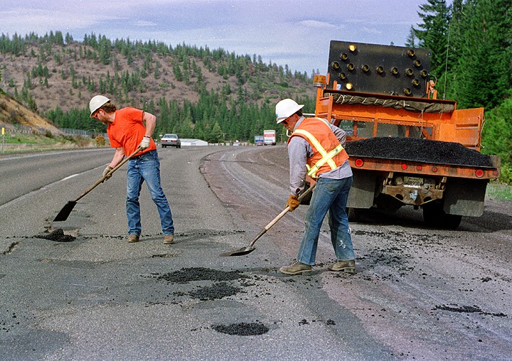
How long for a large pothole to be repaired at state Hwy. 16 and main street in Kerrville?
- William
The pothole has been reported and should be addressed quickly. Thanks for letting us know!

Would you please give me information on the Highland Hills subdivision, Pocahontas Dr., and other roads around the zip code 78264 having construction plans to pave roads.
- Lee
Those roads - all unpaved, private or county roads - are not under TxDOT ownership or maintenance. The best agency to approach with this project would be Bexar County Public Works.

Thursday, October 29

Mail Bag (1 of 2): Wurzbach speed limits (again), potholes, highway signs, Loop 1604 northeast

To those who've reached out to us reporting potholes ... thank you! Those reports have been passed along to the appropriate folks and will be addressed as soon as possible. As for other questions, we've got two Mail Bag posts this week (look for 2 of 2 this weekend).

With just about everyone having access to Google Maps and or cell phones, why don't you include a GPS coordinate description option? This would eliminate cumbersome requested information. Your road crews have cell phones with that resource. Those reporting who don't have a GPS coordinate, can use the other descriptive sources.
- Ruben


Not a bad option, Ruben - provided those using the GPS feature to report the potholes were passengers only. Unfortunately, not enough folks have gotten the message that use of a mobile device - to call or to text - while driving is an extremely poor decision, so we're not about to start providing more opportunities for a bad choice.
Also, as luck would have it, our crews are actually not equipped with fancy GPS gear. We go by good, old-fashioned cross streets and mile markers for the most part. Sure, some of our guys have their own personal cell phones ... but not all have state-issued devices.
That said, if you submit a report with a GPS coordinate, we'll pass it along the same as the others!

Not a question, more of an observation. The questions regarding the speed limit on PA 1502 (Wurzbach Parkway) likely stem from the fact that it feels like it was designed for 60 and the local PD has been providing frequent written and costly reminders that it is currently 45.
- Bill


Bill, we've addressed this issue before. More than once, actually. That said, the issue should be adjusted pretty darned soon - the Texas Transportation Commission discussed this topic in today's commission meeting.

How do I keep myself safe going the 45 MPH posted speed when people are zooming around me going 60-70 MPH? Do I risk getting a ticket to keep up with them?
- Anonymous


The best advice we have is to be patient. As we've discussed before and in the question above, this issue will be completely resolved very, very soon....

Now that all the lanes are open on Loop 1604 on the Northeast Side between Universal City and I-10, would it be possible to have the traffic lights optimized in this area to improve the flow of traffic on Loop 1604? I drive 1604 daily, and I frequently hit every red light between I-10 and I-35, driving with the flow of traffic and at the speed limit. It would really help the flow in this area if the lights were timed better.
- David


Those signals, like most in the region, operate on a VIVD system and are optimized. We have to balance the timing of the signals on your route with the timing of signals on other routes. Heck, most of us have days where we feel like we hit every signal along the way. Every. Single. One. (SO frustrating....)
The signals are optimized, but we can make sure the detection cameras are clean and working as designed. Thanks for letting us know!
By the way, most signals in San Antonio - even those on state-maintained roads - are controlled by the city of San Antonio Transportation and Capital Improvements division.

On Loop 1604 between Braun and Culebra, would it be possible to have Williams Brothers close the third lane, in particular southbound before the turnaround to New Guilbeau and northbound after the turnaround? I recognize that these lanes feed into the turnarounds; however, it seems like it has transformed into a lane for opportunists rather than those desiring to turn left (at the aforementioned areas) and would improve the flow of traffic by eliminating another merge point.
- Ryan


This has been suggested more than once, and we've looked into it with pretty great detail. The problem is, per the engineers who've studied this option and run some models, this will create an even bigger problem with traffic flow than what's out there now.
On the plus side, as was written earlier this week, we could have the intersections at New Guilbeau and (with a little luck...) Shaenfield open to traffic as early as Christmas. That will help us adjust the way things look out there and help stop the folks who are cutting in line as you've observed.

Why are there no overhead signs indicating that the exit lanes on northbound US 281 at Brook Hollow and at Oak Shadows/Winding Way, as well as on eastbound I-410 at Airport Avenue, are exit only? Additionally, there are new signs along US 281 in the vicinity of Wurzbach Parkway that indicate the entrance ramps merge directly into the main lanes of 281. This is not the case. The ramps have their own dedicated lanes that turn into exit only lanes further along.
- Travis


We used to have those northbound US 281 exits marked as you've indicated - and the pavement is marked accordingly. Let us double-check with our traffic operations folks to ensure these markings are appropriate.
The southbound traffic issues you've identified should be corrected by now (in fairness, Travis sent his note to us a few weeks ago and these issues have been resolved, or mostly resolved, in the meantime).

When will the bicycle path west of Jones Maltsberger Road open for use?
- Tom


We're hoping by the end of the year! The rains put a hurt on some of what we've built down there, but we're working to get it all repaired and up to snuff again. Honestly, our contractor wants to be done and over with the project so all resources can be moved to a new job ... so you can bet you'll be riding through the whole thing well ahead of Christmas (and might even be able to do so by Thanksgiving).


How can we get a yellow flashing turn signal from southbound Randolph Boulevard onto eastbound Crestway Drive in northeast San Antonio that will prevent one from having to wait through two light changes to make a left turn?
- Terry


The area you've asked about doesn't fall within the authority of the state's highway department. However, Terry, we've already passed your request along to the good folks with the city of San Antonio - you should hear from them soon!

Monday, October 26

First comes rain, then comes ... well, you know.

We all saw this in May. And in June. For this year, at least, these things crop up more than zombies in World War Z. It makes sense, of course - we're on pace to see more precipitation this year than we've seen since 2007 (and 2007 is the wettest year San Antonio has seen this century).

If only we had Brad Pitt as one of our staff members, we'd solve this forever!

We're talking about potholes. Well, pavement failures of all sorts, really. It's what our maintenance guys spend thousands of hours each year combating, and we can use your help to do it.

Here's the deal: we don't have anyone to just drive around to find problems. We don't have sensors in the roadway to alert us of issues. We rely on folks to tell us where there are problems. We do have a department policy where, as full-time employees, we are asked to report any issues we see in our own driving. With hundreds of employees in the San Antonio region, this gives us decent coverage.

You might see something we don't, however. So if you do see something, help us out! Give us a call and report a pothole or other pavement issue, and we'll put it on our list to be addressed immediately. Here's what you'll need before you dial the phone:
  • Highway you saw the issue on
  • Direction you were driving (N, S, E or W)
  • Nearest cross streets
  • Which lane you were in (left, right, center)
  • Nature of the issue you saw
One very important note: The Texas Department of Transportation is charged with maintaining state highways only. This means roads that have a state highway designation of some sort. This includes Interstate highways (I-10, I-35, I-37 and I-410), US Highways (like US 90 or US 281), Texas Highways (like Hwy 151 or Hwy 46), Farm-to-Market roads (like FM 1560 or FM 2696) and state spurs or loops (like Loop 1604 or Spur 53 or Spur 537).

If it's not a state-maintained road, reach out to the good folks with the city in which you're traveling or your county. They're likely in the same boat we're in, trying to catch up and keep up with the damage from such deluges as we've seen this year.

Oh, yeah ... here's our number:

210.615.1110

Monday, June 15

Mail Bag: potholes, I-10, Wurzbach Parkway, Lp 1604, new subscribe feature

Before we delve into this week's Mail Bag, let us know what you think about the new lane closures format. After all, this blog and its posts are for you and we want to do things in a format suited best for you.

Also, the wet weather we were pummeled by over the weekend (and that's headed our way this week) has a number of consequences. This includes a proliferation of potholes. We're doing what we can to fix the potholes we know about and get to those we hear about from you. The key to avoiding these potholes while you drive, by the way, is to increase your following distance to the recommended 3-plus seconds. This allows enough visual space for a driver to identify normal road hazards, like potholes, and avoid them safely and effectively.

Well, that addresses some comments and questions we've already had in mass since the weekend. Here's a look at a few more specific questions:

The other day I was driving on the WurzbachParkway between Jones-Maltsberger and Thousand Oaks. The new section is fantastic, but I noticed one thing which strikes me as odd - when I got on the highway from Jones-Maltsberger going eastbound, the speed limit is 45 MPH. After Wetmore Road, it goes up to 60. In my unprofessional opinion, the new section is too wide and feels way too slow for the posted 45 MPH. I feel you can definitely drive 60 on it. So my question to you is this: Is the 45 MPH speed limit temporary (until construction ends) or is it permanent? Thanks!
- Mike

It's a good thing most TxDOT vehicles come with cruise control so we can set our speed and be worry free from the temptation of doing 60 MPH on this road!

There are two speeds here - the design speed and the speed that is eventually set through use of speed studies. Because of the inclusion of curbs and sidewalks along the parkway, the design speed is 45 miles per hour. That speed limit can be changed with a speed study and requests from the local municipality. There's a whole process and handbook for stuff like that, if you'd like to go through it all.

The bottom line: expect that 45 MPH speed limit sign to stay where it is (by the way, it's posted at 45 MPH on the west end of the Parkway, between Blanco and West Avenue, also). We'll also be posting 45 MPH signs between West Avenue and Jones-Maltsberger, including the overpass over U.S. 281. Because these are black-and-white signs, they're regulatory. That means our friends with San Antonio Police Department can offer reminders of the posted speed should you be going a little faster. I understand those reminders come only with a fee....

In regards to Braun/1604 overpass - I'm hoping that there are plans to add an additional left-hand turning lane to allow more traffic to get onto 1604 coming from outside the loop. It could really use it. During the school year it can take 5-6 lights cycles to get onto the freeway ... I realize that the project won't be complete until 2016 but it seems like adding another turn lane is something that could be implemented now to reduce some of the pain. Any chances on accelerating this?
- JDH

JDH! Code names ... feels like we're communicating incognito....

The current plan sheets show a single left-turn lane in each direction with an optional straight/left lane for your direction (eastbound Braun Road to northbound Loop 1604). We'll also have a third lane going through at that location. That configuration (straight, optional, left) won't be in place in full until the project nears completion next year.
This shows the final configuration of Braun Road at Loop 1604 when the expansion is finished next year.
Making the adjustment sooner may require some out-of-sequence work on the traffic signals, which may not be ready (we would have to order new components) for quite a while. That said, we can work with the contractor to accelerate the make the optional straight/left lane happen sooner than later.

We recently opened a new campus on Leslie right before Shaenfield. Needless to say this construction is affecting us greatly so I appreciate the updates to help us anticipate and plan. Would it be possible for you to add a feature where I could subscribe to these updates by email so new posts are delivered to my email? Thanks!
- Jamye


You know, that's a darned good idea. There are several options for subscribing (Google+, feed readers, etc.), but if you look to the left of the screen you'll see we just added a subscription option. This will get you an automated email every time we post.

You'll also see that we've added a "share" widget under the blog posts. If you'd like to share a post using your organization's (or personal) Facebook page or Twitter feed (or Google+, Pinterest, email, etc.), you'll find a small strip of icons at the bottom of each post that allows for an easy share.

Great idea, Jamye. Thanks for helping us evolve and develop this blog a bit! If there were such a thing as a "get out of traffic free" card, we'd be sending you one.

Wow, things have really slowed to a crawl on the construction side of things with Wurzbach Parkway. And no updates on here, either. What's the status?
- Michael

The Wurzbach Parkway project is still on pace to finish this summer - well ahead of the end-of-year deadline on our contract. Most of the work is focused along U.S. 281. Tuesdays are our project meeting days, and we'll get on over there to get you an update this week (this project meets the same time as the I-10 Huebner project, so we have to make a choice each week on which to go to).

A stop sign was just installed at the intersection of W. Hausman Rd. and the eastbound I-10 frontage road (near the Land Rover dealership) on either June 5 or 6. A couple years ago this location was converted from a "T" intersection with a stop sign to more of a curved divisional island intersection without a stop sign in order to improve the flow of traffic. Why was a stop sign reinstalled here after not existing for years? Also, many drivers are completely ignoring the stop sign--maybe because they don't know it is there. How come an Advance Traffic Control sign (W3-1) and a NEW sign (W16-15P) were not installed?
- Matt

Matt, two things. First of all, you've got an obvious extensive understanding of our Manual for Uniform Traffic Control Devices - kudos!

Second, that stop sign is part of the Hausman Road project operated by the city of San Antonio. The Transportation and Capital Improvements group there will have more information than we will.

The light at Dezavala and the Eastbound side of the I-10 frontage road has issues. The green light cycle only lasts long enough for about 4 cars to get through. As a result, the traffic backs up onto the frontage road. This Saturday, it took me 5 cycles to get through! I feel like the green light cycles on other sides of this intersection are longer. What can I do (i.e., who can I email or call) to help fix this?
- Lauren

Lauren, this is an issue we've noticed as well. We think it was an issue with a sensor that was pointed in the wrong direction - we've got that solved. If it's a timing issue, that's something handled by the city of San Antonio. Most lights across the city - even on our roads - are controlled by them. Sure, we build them and upgrade them if needed ... but they maintain the timing and so forth.
To put your mind at ease, we're in constant contact with the right folks with the city to be sure we're watching the timing at this location to be sure it's running optimally.

Friday, March 13

Potholes - the what, why and how

Monday morning's commute was jarred for many by a rash of potholes that cropped up on I-35 near Rittiman Road, and potholes in other areas have generated some attention and interest.

For those who've made their home in south-central Texas all their lives, potholes aren't a normal part of life. Those who've lived abroad - especially the northern areas of Not Texas - know potholes happen frequently this time of year as temperatures fluctuate. For those not accustomed to potholes, this is a description of what they are, how they form, why it takes a while to properly repair them and what can be done about hitting them.

In order to help folks understand more about potholes, we've reached out to a pavement expert (he wanted to be referred to as a "Pavement Buttress", which apparently is funny if you're an engineer) in our local district asphalt and materials lab to discuss the in's and out's of potholes. Here's the Q-and-A:

Go Ahead! Blog: How do potholes form – what causes them?

Pavement Buttress: Potholes we are most accustomed to are formed by fatigue (cracking) of the road surface. As fatigue fractures develop into what is known as alligator cracking, chunks of pavement between the alligator cracks are worked loose and eventually picked out of the surface by continued traffic loads. This is what we see in areas with heavier truck traffic, at least.
This graphic, published in 2013 by the UK's Daily Mail newspaper, shows how most of the potholes drivers are experiencing in the metro areas have formed.
GA: Why does it seem like we’ve had so many potholes spring up lately?

PB: Potholes become more widespread during San Antonio’s winter months, due to increased precipitation and increasing the brittleness of the asphalt on many roadways. However, annual ratings of the San Antonio District’s 11,000+ lane miles of roadways has stayed fairly consistent, with areas in the energy sector corridor (Atascosa, Frio, Guadalupe, McMullen and Wilson counties) being a well-documented exception. In these areas, numerous projects are planned or underway to repair the road and the in-house maintenance forces are working as diligently as possible to keep up with the issues.

GA: What does it take to repair the potholes?

PB: It depends. If there are a few spot locations, in-house state maintenance forces will address the potholes by filling with patching material. Patching material can be kept in containers, in bags, or stockpiled as an open pile. In all of these cases the patching material is easily portable in standard pick-up trucks. It is applied by filling the pothole, and tamping it in place (often by simply rolling over the filled pothole with a truck) to create as smooth of a surface as possible.

If the potholes are more severe, repair could require milling off multiple inches of the pavement and relaying with stockpiled patching material, cold-mixed bituminous material, or even laying hot mix asphalt.
This stock photo from an asphalt company shows crews milling away several layers of asphalt, probably to repair the road.
There are also times when the potholes are so severe that rehabilitation or reconstruction of the roadway could be necessary. This would require putting out a project to bid.

GA: How long does TxDOT let a pothole sit before we repair it?

PB: TxDOT in-house maintenance forces are available should a roadway concern arise. There is no set time frame on how long TxDOT may wait before addressing a pothole. TxDOT’s maintenance forces maintain a constant supply of patching material on-hand to address any potholes as they arise.

Note: TxDOT leaders have determined that using state resources to patrol all 11,000 miles of highway within the district isn't the best use of state resources or tax money - especially when those resources can be dedicated elsewhere. However, it's a district policy that a TxDOT employee should report a pothole observed, whether the employee is driving on their own time or as part of their normal course of duties. Once a report is received, crews are dispatched to address the issue. TxDOT also depends on road users to report these problems so they may be addressed appropriately.

GA: Why does it seem like these repairs don’t really hold up for very long?

PB: Many pothole repairs have actually lasted multiple years. In cases where there truly are potholes in constant need of repair a simple “fill the hole” approach (described above) may not be the right solution. In these cases the pothole is more a symptom of a larger problem. For example, if the existing soil is so weak that it cannot support the traffic on the roadway, then patching the pothole will only mask the problem. However, TxDOT often needs to use a temporary fix - a Band-Aid of sorts - until a more lasting fix can be done. While an in-house patch may not fix the problem it will provide a safer roadway to drive on until a better solution is possible. Also, an exposed pothole is a conduit for moisture to enter into the soil, make it weaker, and make the pothole worse.
Highway crews in California fill in potholes as a temporary measure until a long-term fix can be done. This photo comes from the California Department of Transportation.
Many in-house patches are methods for TxDOT to hold a pavement together until the appropriate construction project can be developed and implemented. These projects require clear, dry weather for a stretch of several days, or the project will be nullified by the wet and less-stable material.

GA: What can be done to provide a more lasting fix for the potholes we’re seeing?

PB: TxDOT is, and has been, a national leader in innovative techniques and materials. Because of TxDOT efforts pothole repair materials have actually gotten better over time. For example, historically patching material was only able to be obtained in bags or containers to keep light-end oils in the material allowing it to stay workable. Through partnerships within the industry, TxDOT has developed a patching material that can be stockpiled for 6 months and still maintain its workability. This has enable larger patches to be addressed and perform longer.

GA: Is there a roadway material we can use that won’t see potholes? If so, why aren’t we using it?

PB: Any material used on a highway will ultimately encounter varying environmental, traffic, and construction impacts - all of which can have an impact on the roadway’s ability to resist potholes. Unfortunately, because each one of these elements is very dynamic, it’s virtually impossible to prevent all the variables from never causing a pothole.

There are materials and pavement structures that are more resistant to the formation of potholes than traditional asphalt, but TxDOT has a responsibility to taxpayers to ensure all roadways are engineered to provide an adequate functional performance. In addition to potholes, TxDOT evaluates rutting, longitudinal cracking, alligator cracking, spalling, and punchouts. Functional characteristics can include smoothness, raveling (what folks have seen through February on U.S. 281 near Hildebrand), and flushing. Each one of these characteristics are considered along with the amount of traffic, weights, and environment to develop a pavement system that will function accordingly. To only design a road to account for potholes is not sufficient.
Continually reinforced concrete roadways are one option to reduce pothole occurrence, but they are too costly to be feasible in south-central Texas.
In addition, if TxDOT were only to select materials that were highly resistant to potholes, a fiscal inequity would develop. For example, continuously reinforced concrete pavement (CRCP) may be considered a material that is more resistant to potholes than a thin layer of asphalt and rock (seal coat), but because CRCPs unit price and quantities are so much higher than a seal coat it is difficult to justify and prevent other roadways from being maintained or expanded.